Category Archives: transportation
Rail Viaduct Work
Cherry Street Manhole Work
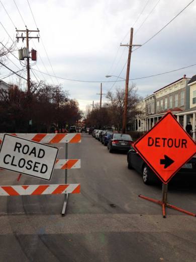
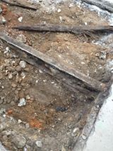
Today the crew uncovered one of the old trolley tracks on the 300 block of S. Cherry Street. (To learn more about the trollies, you may want to check out the documentary-in-progress, Richmond Had Rails.) Tomorrow morning they will be cutting it to make room for manhole which rises from directly underneath it.
Railroad in The Penitentiary Basin
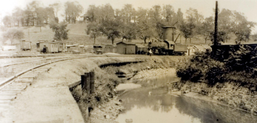
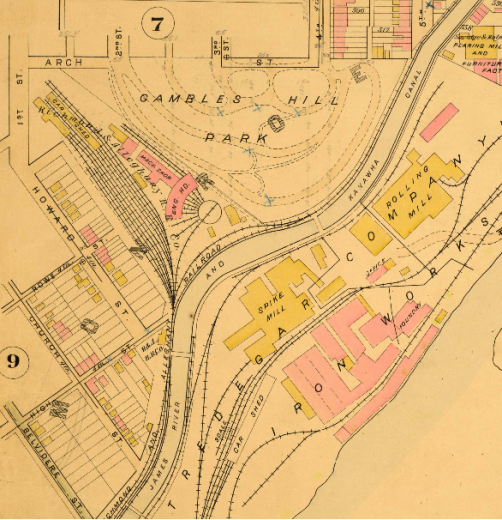
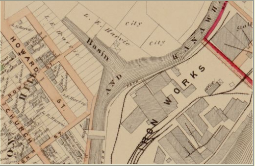
The Penitentiary Basin was dammed at the beginning of the 19th century, between Oregon Hill and Gambles Hill and below the Va. State Penitentiary. It served as an important turning basin for canal boats traveling the James River and Kanawha Canal. Canal boats offloaded supplies, and there was a canal boat building business in the Basin. The 1876 Beers Atlas shows the Basin below Oregon Hill at a time when canal boat traffic was being replaced by the more versatile railroads. In March 1880 the James River and Kanawha Company conveyed all of the canal property to the Richmond Alleghany Railroad, and the Penitentiary Basin soon was filled in and became a busy rail yard with turntable and machine shop. The 1889 Baist Atlas shows the remarkable transition from the previous decade as the extensive railroad infrastructure replaced the canal boat traffic. The water from the James River and Kanawha Canal continued to power the waterwheels at Tredegar Iron Works well into the 20th century. The attached photograph shows a steam engine beside the canal filling up with water from the tower located at the former Penitentiary Basin. Pratt’s Castle on Gambles Hill can be seen directly above the water tower. The former Penitentiary Basin is now owned by NewMarket Corporation, and it is hoped that they will be respectful of the rich history of this site.
Photo credits:
Canal/Railroad photo, Library of Virginia;
Baist Atlas, 1889, VCU Libraries;
Penitentiary Basin, Beers Atlas, 1876, Library of Congress
Projected Density
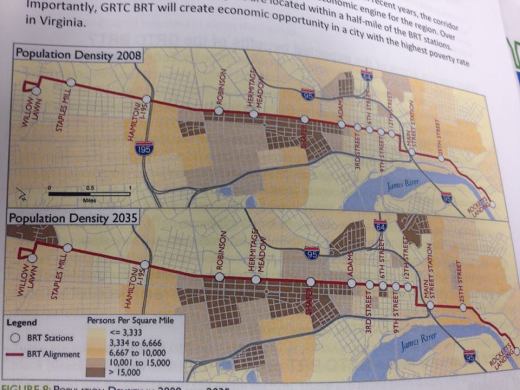
From the GRTC BRT handout…
Letter To VCU President Rao On Bus Rapid Transit Debate
Email sent June 11 to VCU President Rao and City Councilperson Agelasto:
President Rao,
Thank you and the VCU Department of Community Development so much for hosting the VCU-Neighborhood Forum this afternoon. I do enjoy the chance to meet and discuss issues with the VCU administration.
As I brought up at the meeting, the Oregon Hill Neighborhood Association would appreciate it very much if the inappropriate billboard-style signs at Belvidere and W.Main and at Belvidere and Cumberland could be removed. We are hoping that more appropriate signage can be installed with the City’s cooperation and input. And I was very sincere when I complimented VCU for the fine work of its police force. It really has helped change VCU’s relationship with surrounding neighborhoods for the better.
But I am writing to you and Councilperson Agelasto to follow up on two of the more contentious issues at the meeting, namely, the Bus Rapid Transit proposal and increased parking pressures. You heard Jon Marcus of the W. Grace Neighborhood Association give his issues with the current BRT proposal. You also heard Councilperson Agelasto’s challenge to VCU in regard to supporting BRT (something that I brought up at last year’s VCU Monroe Park Neighborhood meeting).
After you left the meeting, many neighborhood representatives expressed concern about the impact of additional student units from a larger Gladding Residence Center on W. Main. Jennifer Hancock, OHNA’s President, noted to me after the meeting that even the Fan neighborhood, with all of its decals and controlled parking, is still very worried about VCU student parking.I would like to offer a possible 2-in-one solution to both of these matters:
We all want BRT to succeed in offering better mass transit to Richmond residents and VCU students, even if many strongly disagree with the current proposal. Indeed, some of us are worried that if it fails, it will set back mass transit in Richmond for years. That said, the current proposal needs more attention. Citizens and businesses have legitimate criticisms that should be listened to and taken seriously.
Personally, I believe that without considerably more commitment and support from the county governments, the BRT proposal should be reoriented towards serving the City (and VCU) more by becoming part of a new, inner-city circulator proposal. GRTC says that it has not been able to gain any traction with a circulator in the past, but previous attempts have been unreliable and anemic, only serving small parts of downtown and barely impacting midtown. If VCU (and U of R, and VUU) worked with GRTC, I believe a much more robust and satisfying inner-city circulator could be developed that could serve citizens, tourists, and students. Imagine a strong loop that included a slightly reformed Broad Street BRT as well as Boulevard, Main Street Station and Shockoe Bottom, and the entire Cary Street corridor. This circulator idea would not preclude extending BRT into the counties, converting to light rail, or adding more connecting, regular GRTC bus routes now or in the future.
Such an inner city circulator could totally change perspective and thinking about the new Gladding Residence Center. We know that VCU students want access to downtown, other transportation options (Main Street Station), and Carytown shopping. This would give them access to those things and make it easier for students (and especially first-year GRC students) to live without cars on the Monroe campus. This would enable VCU to truly transform and brand the Broad Street corridor while also helping other portions of its campus, including and connecting south of Main and Monroe Ward. By supporting the circulator, VCU could live up to claims about investing in the City of Richmond and overall sustainability.
(At the risk of overreaching, I will add that, in regard to Main Street Station, the City should really give up on its wasteful Shockoe baseball stadium scheme and dust off former GRTC CEO John Lewis’ plan to turn the train depot shed into the downtown GRTC bus transfer station. That, along with a shuttle to the airport, would make Main Street Station truly multimodal transportation and help establish Shockoe Bottom as THE transportation center of the region if not the entire state. Any help you can give to nudging the City back on the right path towards this would be greatly appreciated.)
I look forward to hearing your thoughts on this and other matters.
Sincerely,
Scott Burger
—
In response, Councilperson Agelasto noted that City and GRTC is in the final “review of potentially reinstating bus service along the Main/Cary corridor between the James Center downtown and Carytown. If approved by the Federal Transportation Authority, this could be implemented this October.”
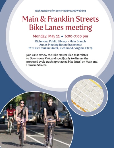
Downtown RVA Bike Lanes meeting – This Monday
Riggan’s Canal-Blueway Plan
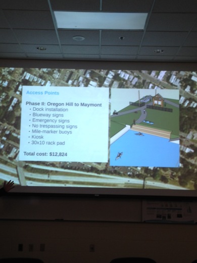
Phil Riggan, who now writes the “Why Richmond, Why?” column for the Richmond Times Dispatch, earlier this week presented his final project for his VCU studies, a plan for making the Kanawha Canal between Oregon Hill and Bosher’s Dam into a recreational ‘blueway” for the James River Park system.
Click here for a copy of his presentation. A full written report/plan should be available in the near future after Riggan makes some final edits.
A couple of points about the plan- It was made with the help of the Friends of James River Park and the James River Outdoor Coalition. Nathan Burrell, the Director of James River Park, afterwards remarked that he thought it was actionable and doable now, as long as there was permission of stakeholders (CSX, Department of Public Utilities (DPU), and others) and available financial resources. It has already received letters of support from the James River Association and the Falls of the James Scenic River Advisory Committee.
Riggan knows about the 1988 canal restoration plan (the one that Venture Richmond ignored) and says he has included it in his final report. It is noteworthy that his plan starts with “Mile 1” at the start of the North Bank Trail near the S. Cherry cul-de-sac, and not “Mile 0” near the Lee Bridge. Riggan’s plan recognizes that DPU needs to complete engineering in order to get the water level right for recreational traffic (elevation verified at 83 feet). Some Oregon Hill neighbors are suspicious that perhaps that was the real goal of the Tredegar Green amphitheater, to damage the historic Kanawha Canal to the point where now the terminus of the “rewatered” canal is at “Mile 1”. That said, Riggan’s plan comes from a recreational paddling sport perspective and if it is successful, it may increase pressure for FULLY renovating, re-watering, and re-connecting Richmond’s historic canals.
Dinamo Starting Delivery Service Through Quickness RVA
W. Cary Street restaurant Dinamo will start food delivery service on Monday through
Quickness RVA (www.quicknessrva.com).
Here’s a sneak peek at their delivery menu:
dinamo delivery menu
monday – thursday
11 am – 9 pm
delivery special
red or white pizza w/ one topping & bottle of wine 25.
soup / antipasti
matzoh ball soup 5.
soup of the day 5. and up
mixed green salad 6.
lentil salad 7.
roasted red pepper w/ bufala mozzarella 15.w/ anchovy 16.
beet & fennel salad 12. w/ feta 13.
arugula & asparagus salad w/ egg 13.
crostini / flatbread
crostini w/ chopped liver 8.
crostini w/ cured salmon 8.*
crostini w/ smoked whitefish salad 10.
hearts of palm & chickpea w/ flatbread 10.
sandwich / entree
turkey sandwich 10.
bufala mozzarella & prosciutto sandwich 12.
corned beef sandwich 12.
reuben 13.
broccoletti & provolone sausage w/ polenta & beans 15.
pizza
red pizza 10.
white pizza 11.
add topping $1 each: sausage, mushroom, onion, anchovy, olive
dessert
chocolate espresso torte 6. w/ whipped cream & cherries 9.
tiramisu 8.
mini cannoli 2.25
beverages / beer & wine
coke / sprite (8 oz glass bottle) 2.
san pellegrino limonata or aranciata 2.5
san pellegrino (500 ml) 3.5
birra moretti lager (11.2 oz) 4.5
tiamo prosecco (187 ml) 10.
red wine bottle: masciarelli montepulciano 20.
white wine bottle: agriverde trebbiano d’abruzzo 20.
Richmond Had Rails: a kind of time travel
From Richmond Had Rails FaceBook page:
VCU Libraries today announced the launch of an interactive version of a Richmond map atlas from 1889, allowing for a kind of time travel, because through the use of overlays, viewers may compare the cityscape of then with that of today (courtesy an integration with Google Maps). The application features photos and illustrations due to linkage with VCU Libraries’ extensive collections of antique images.
Of interest to those following the progress of “Richmond Had Rails” is that the Baist Atlas Map received publication just a year after the trolleys started rolling in Richmond. On Panel 16, which surveys Church Hill, you can see the site of the shops where Julian Sprague and his team originated the first ever city-wide electric powered streetcar. The technology utilized then is, with some improvements, still what powers transit throughout the world, when Richmond had rails.
Here’s the interactive Baist Atlas: http://labs.library.vcu.edu/baist-atlas/
And a link to a VCU news story: https://news.vcu.edu/article/Interactive_map_from_1889_reveals_Richmonds_rich_architectural

