GRTC Task Force Meeting Today

From City press release (It’s somewhat ironic that this site is one of the only local news sources covering this as Oregon Hill lost its bus route over a year ago, but hey, its just the future of mass transit in the area, nothing to see here):

Richmond City Council GRTC and Transit Study Task Force to hold second meeting

All residents are invited and encouraged to attend

WHAT The Richmond City Council GRTC and Transit Study Task Force will hold its second meeting. This meeting will include a presentation to the Task Force by the GRTC Transit System on the current state of the GRTC Transit System. The purpose of the Task Force is to make recommendations to Richmond City Council with regard to enhancing mass transit in the Metro-Richmond area and the efficiency and effectiveness of the GRTC Transit System. The meeting is free and open to the public and all residents are invited and encouraged to attend.

WHEN Thursday, February 9, 2012
4:00-6:00 p.m.

WHERE Richmond Department of Economic Development
Richmond Main Street Station 3rd Floor Conference Room
1500 East Main Street; Richmond, Virginia 23219
(PARKING: Free parking is available on the west side of the building by using the
Franklin Street Entrance and using the lot below the Interstate. When facing the
Train Station from the Franklin Street Entrance, make a right and park towards
the Clock Tower end. When facing the building from the parking lot, the
entrance door to the Richmond Department of Economic Development is
located on the right of the building.)

WHO Members of the Richmond City Council GRTC and Transit Study Task Force
The Honorable Bruce W. Tyler, Councilman, Richmond City Council,
West End 1st District,

CONTACT For more information, please contact Councilman Bruce W. Tyler, Richmond
City Council, West End 1st District, at 804.357.6007; or
bruce.tyler@richmondgov.com.

Background ____________________________________________________________________________

Richmond City Council GRTC and Transit Study Task Force
Richmond City Council established the Richmond City Council GRTC and Transit Study Task Force on September 27, 2010 by Richmond City Council Ordinance No. 2010-173-166.

The objective of the Richmond City Council GRTC and Transit Study Task Force is to provide a report to Council within in a year of its first meeting which recommends the following:

1. Any legislation, plans, policies, and programs that promote efficient mass transit in the city;

2. Economic development, economic growth, employment and tourism strategies that include public transportation; and,

3. Public relations and education programs to increase public use of mass transit.

4. The Task Force shall also work with interested private organizations to improve the service and efficiency of the GRTC.

Sierra Club Speaks Against Proposed 2nd Street Connector

The letter:

February 1, 2012
Honorable Dwight C. Jones Office of the Mayor
900 East Broad Street, Suite 201 Richmond, Virginia 23219
Re: Opposition to Proposed 2nd Street Connector

The Sierra Club Falls of the James group would like to express our many concerns regarding the recent proposed riverfront development just west of downtown. In particular, we see several issues with the proposed “2nd Street connector road.”

Lack of Amenities for Bicyclists and Pedestrians
First, we share the concerns expressed by neighborhood and bicycle groups about the lack of bicycle lanes and pedestrian features in plans for this development. It is absolutely hypocritical for the City to declare itself “bicycle-friendly” while creating a new roadway in its downtown riverfront without these measures. This sends all the wrong signals as the 2015 World Road Cycling Championship approaches.

Disrespect for Historic Context
Secondly, we are very interested in protecting the historic features of the Kanawah Canal that this proposed roadway will bisect. The canal, listed on the National Register of Historic Places, is of great historical significance to the City of Richmond. It was first development of the city. Samuel Pleasants Parsons, a noted abolitionist, whose home (built in 1819) survives at 601 Spring Street, was the Superintendent of the Canal in 1840 when the Canal was expanded westward to Lynchburg. From about 1850 to 1875, John Messler ran a canal boat building enterprise in the Penitentiary Basin. Messler had a short walk from his home the Jacob House (which survives at 619 W. Cary Street) to the canal basin. Based on these facts alone, we believe that any construction in the area should be preceded by careful archeological investigation. All of the historic images of Richmond’s Kanawha Canal emphasize how important this area is to the City’s identity, and it deserves better than the typical corporate campus driveway treatment.

Environmental Degradation and Canal Boat Impasse
Thirdly, in addition to the history of the canal, its natural aspects also bring up important environmental concerns. Putting a paved road over the canal and so close to the river will have a significant effect on stormwater runoff in the area. With the James River Park so close by, any development of this area will have an adverse effect on the environment. We understand that the land above the canal area is ready for development, but the canal area itself is not. While much of the land for this proposed road may be on private property now, for the City to accept its donation under these circumstances is not proper environmental stewardship.
Moreover, we are listening to Jack Pearsall, who has served with the Historic Richmond Foundation and City planning committees and who has championed the canal as a transportation alternative. He has raised red flags with regard to how this proposed road will meet the historic canal. He has estimated that the culvert would be about 12 feet high with only about 6 feet of clearance if water flow were restored. That means typical canal boats would not be able to pass.
In a recent Richmond Times Dispatch article, Mr. Pearsall was quoted as saying, “The purpose of the canal is to float boats. If we’re going to float boats on this canal, they’ve got to be able to pass this constriction.”

Disregard for Possible Alternative Future Uses
We also note public support for this restored canal concept. There was support for it twenty years ago, and support for it was again expressed at the recent public riverfront planning meetings. Planning for the canal might be a question of whether the chicken or the egg comes first. At first the canal might be seem to be mostly for tourist boats up to Maymont and an extension of the history tour on the canal downstream; but some day the larger culture may see the benefit of and begin to use “water taxi” for transporting commuters downtown or to the slip, and eventually it may be functionally necessary again for commercial forms of traffic moving up the river. Navigable water is wisely being mapped with an eye on the future value to the state and municipalities as real estate. The movement to open and protect blue-ways is focused especially on keeping a cap on the scale of expansion or commercialization. Re-opening the canal must also be designed within the context of supporting conservation easements to prevent sale of any segments of James River Park.
We might say to ourselves that that little canal would have to be expanded to carry significant traffic once again, yet we must also look at the canal as it is: an existing option that we protect with foresight now while we have the chance, in preparation for the time it might need to be pressed into service because of a lack of resources for the kinds of massive infrastructure projects that we in our time are temporarily fortunate enough to consider ordinary.

Exacerbated Traffic Problems
Finally, we share concerns expressed by neighborhood groups with regard to traffic and further riverfront development. We recall our opposition, along with that of over a dozen other neighborhood and environmental groups, to Dominion Power’s Special Use Permit for its headquarters building on the riverfront. At the time, traffic was brought up as a chief concern, and Dominion assured City Council that existing roadways could serve the additional traffic created by its development. Now ten years later, Dominion is insisting on this new road while at the same time saying it has no plans for new development “at this time.” Oregon Hill neighborhood residents have made it clear there already are problems with additional traffic coming from the 195 expressway onto Idlewood Avenue that would be exacerbated by the 2nd Street connector. The City Department of Planning has not delineated the necessity of this road for emergency access.
In summary, the Sierra Club Falls of the James Group does not see the purpose of this road, and more pointedly, we are opposed to its current planning for the reasons set out above. We are not totally opposed to development in the area, but what has been suggested so far in regard to the Kanawha Canal and the 2nd Street Connector is not acceptable. We welcome the opportunity to discuss this matter with you.

Sincerely,
Adele MacLean, Co-Chair

Cc: City Council, Planning Commission

Street Cleaning Starts Tomorrow

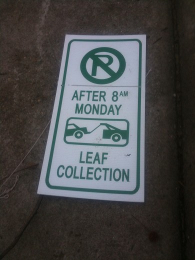
Last night someone tore down a lot of the temporary street cleaning signs that were put up by the City (as well knocking over a trash can or two and being an asshole in general).

Despite this, the City should be starting street cleaning with the west side of S. Laurel Street tomorrow. Beware, cars should be towed, as some blocks should really get cleaned of fallen leaves.

GRTC Task Force To Meet Thursday

From City Council announcement:

First meeting of the Richmond City Council GRTC and Transit Study Task Force to be held

First meeting of this important Task Force

WHAT The first meeting of the Richmond City Council GRTC and Transit Study Task Force will be held. The purpose of the Task Force is to make recommendations to Richmond City Council with regard to enhancing mass transit in the Metro-Richmond area and the efficiency and effectiveness of the GRTC Transit System. This first meeting will serve as an organizational and planning session to develop a work plan for the Task Force. The meeting is free and open to the public and all citizens are invited and encouraged to attend.

WHEN Thursday, 12 January 2012
4:00-6:00 p.m.

WHERE Richmond Police Academy
1202 W. Graham Road, Room 247
Richmond, Virginia 23220 (In Richmond’s Northside)
Free Parking is located in front of the building.

WHO Members of the Richmond City Council GRTC and Transit Study Task Force

CONTACT For more information, please contact The Honorable Bruce W. Tyler, Councilman, Richmond City Council, West End 1st District,
at 804.357.6007; or bruce.tyler@richmondgov.com.

Background ____________________________________________________________________________

Richmond City Council GRTC and Transit Study Task Force
Richmond City Council established the Richmond City Council GRTC and Transit Study Task Force on September 27, 2010 by Richmond City Council Ordinance No. 2010-173-166.

The objective of the Richmond City Council GRTC and Transit Study Task Force is to provide a report to Council within in a year of its first meeting which recommends the following:

1. Any legislation, plans, policies, and programs that promote efficient mass transit in the city;

2. Economic development, economic growth, employment and tourism strategies that include public transportation; and,

3. Public relations and education programs to increase public use of mass transit.
The Task Force shall also work with interested private organizations to improve the service and efficiency of the GRTC.
– E N D –

A few other points of information-

Oregon Hill’s bus route that came down to China Street was eliminated over a year ago, though you may still see bus stop signs in the neighborhood.

According to transportation application Abogo, the transportation cost for an average household in Oregon Hill is $629/month vs. a regional average of $844. While transportation CO2 impact for an average Oregon Hill household is 0.29 metric tons/month vs. a regional average of 0.78 metric tons.

The RVA Green roadmap for Sustainability, updated as of last month, has some recommendations for GRTC on its last few pages.

Historic Canal Area Controversy Continues

The Times Dispatch had a report on a recent Planning Commission meeting about the proposed 2nd Street Connector. It did not mention Oregon Hill citizens’ troubles with the project, but it did focus on concerns about what the road might mean for future use of the historic Kanawha Canal.

Excerpt:

The Richmond Planning Commission on Tuesday approved a final design for the estimated $1.3 million Second Street Connector despite concerns that the culvert may be too small to allow boats to pass if water flow could someday be restored to the canal.

“The purpose of the canal is to float boats. If we’re going to float boats on this canal, they’ve got to be able to pass this constriction,” said Jack Pearsall, who is trying to reignite interest in restoring a functional canal system stretching from Great Shiplock Park to Maymont.

Pearsall, who served on a Historic Richmond Foundation committee that studied the idea more than 20 years ago, estimated that the culvert would be about 12 feet high with only about 6 feet of clearance if water flow were restored. That means typical canal boats wouldn’t be able to pass, he said.

Meanwhile, C. Wayne Taylor has compiled some very interesting images of the canal area on his blog. They are well worth checking out. If nothing else, they give some perspective on how important this area has been to Richmond’s identity over the decades.

Which vision will City Council and City government ultimately align with, the citizens’ desire for a working, refurbished canal or another corporate driveway? Who does the City work for?

East Coast Greenway To Cross Lee Bridge

Planners at last Tuesday’s riverfront planning meeting were asked where the East Coast Greenway would be crossing the James River. According to their answer, the ECG’s route will come through downtown but then jog westward along the Canal Walk and come to the Lee Bridge.

Here’s an excerpt from a recent Treehugger.com post about this exciting bike trail development:

If you think highways and flight paths are the only ways to travel long distances in the United States, check out the East Coast Greenway. The network of bike trails and bikeable roads stretches nearly 3,000 miles down the eastern seaboard, from Maine’s border with Canada to Key West, Florida.

In the works since 1991, the route is officially complete, but still very much a work in progress. The goal of the East Coast Greenway Alliance (ECGA) is to have it run entirely on dedicated traffic-free trails, but at this point, nearly three quarters is on regular, if calm, roads.

The ECGA does not create the trails itself, but rather works with local organizations and agencies in the fifteen states it traverses to bring route sections together and to ensure that they all meet the proper criteria. If you live on the East Coast or pass through for a visit, the ECGA provides maps and information for each state’s route.

While circuitous routes off-road trails are preferred to direct on-road ones, the Greenway remains an urban trail system. It is more concerned with transportation than recreation, and connects 25 major cities, including New York, Washington, D.C., Richmond, Raleigh, Charleston and Miami.

Riverfront Planning Meeting On Tuesday

With James River Park leader Ralph White retiring, citizen input for riverfront planning may become even more important.

CITY OF RICHMOND Riverfront Plan

The Department of Planning and Development Review invites members of the public to attend the third Public Forum on the Richmond Riverfront Plan:

Tuesday, December 13, 2011
6:00 pm
Virginia War Memorial
621 South Belvidere

The Consultant Team from Hargreaves Associates will present a draft plan that outlines the overall design concept for Richmond’s riverfront, followed by an opportunity for public comment. The draft plan will describe public realm improvements, emphasizing pedestrian and bike connections, transportation corridors, and identification of anticipated future private development, with a prioritized plan for implementation.

The presentations from the first and second forums are available on the Department of Planning and Development Review’s webpage on the City website at www.richmondgov.com

Parking is available at the Virginia War Memorial, the adjacent Virginia Housing Development Authority, and along Second Street.

For more information contact
James Hill, City of Richmond
Telephone: (804) 646-7552
E-mail: James.Hill@richmondgov.com

Bridge Improvements Too?

As we look forward to Holly Street playground improvements, hope for green alleys and Idlewood roundabout, and stubbornly await OUR canal bridge, we might consider this discussion on Church Hill People’s News about proposed modifications of the Martin Luther King Bridge. (Click here for link)

How about Oregon Hill’s 195 overpass/bridges? Would we want to similar improvements? Or should we hold out for a bigger project to cover the 195 expressway completely, making the “highway” a tunnel and reclaim the space above?

Report From VCU Master Plan Meeting

A resident reports back from a new VCU Master Plan meeting (reposted here with permission):

Hi all-

I attended a meeting for community members wednesday afternoon to give initial concerns toward the new VCU masterplan getting ready to be shaped. Other community members from the Fan, Monroe Ward and MCV community were there as well.

There was an OVERWHELMING consensus among all the neighborhoods represented that past VCU administration had not kept their word on previous masterplans nor on individual agreements they had made with them.

I said that Oregon Hill REQUIRES a legally binding agreement to establish a boundary of Cary Street which VCU cannot cross. The moderators told the group that the current enrollment had leveled off and that they were concentrating on improving what they have, maybe adding up to 500 faculty members in the next 6 to 9 years.

Other concerns I brought forth were the need for the roundabout and 2 way traffic on Idlewood between Cherry and Harrison so VCU cars getting off the Downtown Expressway can turn to go toward the Harrison street parking deck without going through Oregon Hill causing congestion. In addition I stressed accountability for all of their facilities including the parking problems which were exacerbated by the building of the new rec center.

We desperately need support from our Councilperson on meeting these goals for improving quality of life issues in Oregon Hill regarding VCU’s presence.

Your neighborhood association meets every 4th Tuesday of the month at William Byrd Community House at 7PM. Please come out and get involved to make Oregon Hill a better place to live!

Thanks.