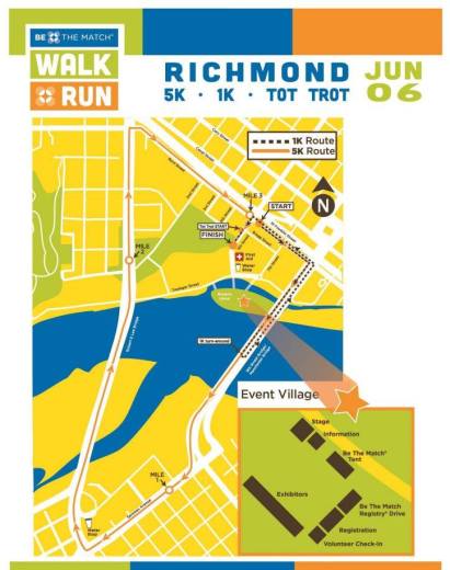
On Saturday, June 6, Brown’s Island will host the 2015 Be the Match Walk & Run. The course suggests that there may be traffic delays on the Lee Memorial Bridge and Manchester Bridge beginning at 7:00 am.
Category Archives: traffic
VWM 5K This Saturday
The Virginia War Memorial 5K Run/Walk To Remember will be Saturday, April 18th. The race kicks off at the Memorial @ 8:30 a.m. and will be travelling through Oregon Hill between 8:30 a.m. and 10:00 a.m.
Organizers are expecting 500+ participants and over 600 military running in formation. There will be Course Marshals and Fort Lee soldiers along the route and at each corner. Richmond City Police will be involved with the race too. Only 2nd street and Belvidere from Byrd Street to the Lee Bridge entrance ramp will be closed, but due to the number of participants there might be a few delays on the streets involved.
This race is a wonderful opportunity for the public to honor and remember veterans.
Illegally Demolished Historic Wall To Be Rebuilt HIGHER
After the historic Tredegar wall was illegally demolished several years ago, and much controversy resulted, several promises were made to rebuild the wall.
Recently, a neighbor who works in historic preservation has been helping preparations to finally start work on rebuilding the wall.
However, this website has recently learned that there are new plans to rebuild the wall at least twenty feet higher than its previous height. No one could comment on this development at press time.
While it remains a mystery as to the exact reasons being given for this raise, there is some speculation on the need to use ‘extra’ historic bricks that will be made available from the planned updating of old City Hall. Some Oregon Hill residents believe the higher wall will be used to host community movie screenings, while others believe that the City is preparing the wall for river level rise due to climate change.
Please stay tuned as this story develops.
New Nearby Development
From the article:
Richmond’s own TriBeCa – a cluster of brownstone three-story homes on the easternmost edge of the Randolph neighborhood – has begun work on six more units, with nine additional detached homes planned next year.
The Lower Manhattan neighborhood’s name is an acronym for Triangle Below Canal Street, and its Richmond counterpart is short for Triangle Below Cary Street. Its inspiration is a triangle of land that is bordered by South Harrison Street and Grayland and Idlewood avenues.
It’s interesting that the article makes no mention of the Idlewood roundabout project, which should be starting construction also.
Contentious Fence Proposal Withdrawn
According to an official in the City’s Dept. of Planning and Development Review, the Location, Character and Extent item for the Brown’s Island Way fence and gate (UDC #15-02) has been withdrawn from consideration from the Planning Commission. It will appear on the agenda for the meeting on March 2nd as a formality, noting its withdrawal. That agenda should go out later today.
For background on this, please visit the following links:
Fences of Contention III
Fences of Contention II
Fences Of Contention (I)
Protest Against Dominion
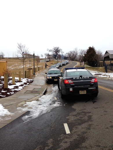
This morning there was a protest march against Dominion Power that purposefully blocked the intersection of Tredegar Street and Brown’s Island Way (aka 2nd Street Connector) to raise awareness of Dominion’s role in profiteering, pipelines, pollution, and climate change. Eventually fire trucks were called to assist a massive police presence in clearing protesters from the street.
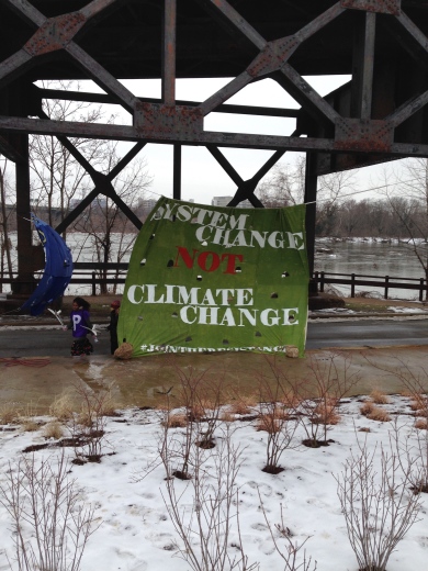
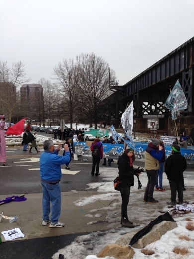
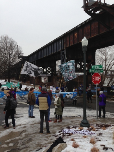
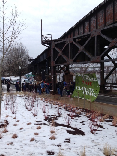
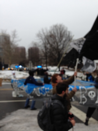
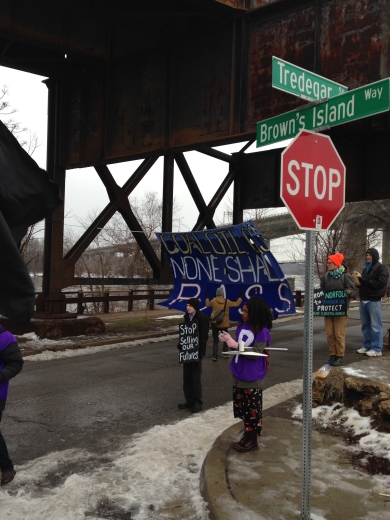
Editorial: You have to wonder if Dominion executives are regretting their arrogant insistence on building their riverfront headquarters and 2nd Street Connector. Their corporate hegemony, combined with some of their biggest supporters corrupting and dishonoring state office is just making citizens angrier.
Harrison/Cumberland Intersection Still Closed?
Residents and visitors are wondering when the intersection at Cumberland and Harrison will reopen, after water main repairs. News reports last mentioned it should be open on Feb. 2, but here we are three days later…
Following this traffic headache, there is likely even more support for the Idlewood roundabout project.
Turning Truck On Cherry
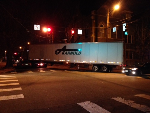
A neighbor took this photo yesterday evening.
This poor guy has been trying to get around this corner for 45 minutes. I don’t see how he can without demolishing the hydrant. Lucky he had a rider guiding him. This is Cherry and Idlewood. I don’t think these streets were designed to accommodate 18 wheelers…
Update on Replacing The Illegally Demolished Tredegar Wall
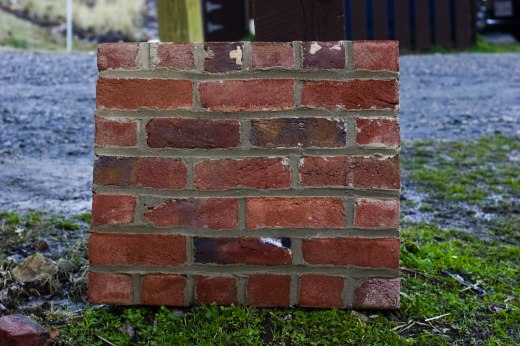
Pine Street neighbor Bryan Green, who serves on the City’s Urban Design Committee, has made a test panel for replacing the illegally demolished Tredegar wall. Because there isn’t enough surviving brick to rebuild the wall, he has ordered hand made brick from North Carolina. The test panel is by the sign in the Belle Isle parking lot.
Bryan thinks that they will start on rebuilding the wall as soon as they get in the proper mortar and when it warms up a bit. He hopes to supply some more details soon.
Fences of Contention III
An update on the Fences of Contention saga (Here are links for Part I and Part II):
Councilperson Agelasto spoke with the City Attorney about the 2nd Street Connector legal agreement and the $53,000 budget requirement for the fence. The original agreement has been completed and is now closed. The City has no further obligation to complete the fence. In order to fund the budget, this will require the City Council to approve a budget amendment.
Yesterday, the Planning Commission review was supposed to consider the authorization of the “location, character, and extent” of the fence, but due to other issues on their agenda, the meeting went on too long and the fence item was continued until the next meeting February 2nd. According to neighbors who did attend and spoke with officials after the meeting, the City administration is still trying to maintain that the fence was paid for through the authorizing ordinance (despite the City Attorney’s opinion.)
But looking back at the authorizing ordinance for the 2nd Street Connector (Brown’s Island Way), the plans were NOT included in the ordinance or the agreement attached to the ordinance.
If plans had been included, they would have been attached to the agreement as an exhibit. These are the only exhibits attached to the agreement:
Exhibit A. Description of the Property
Exhibit B. Project Area
Exhibit C. Description of City Property
Exhibit D. Project Standards
Exhibit E. [Payment Schedule]
Exhibit F. Lease Agreement
Exhibit G. Construction Plan Showing Curb Cut Overlaid on Exhibit B “Project Area”
Exhibit G is for item 2.d of the agreement:
(d) Grantor shall have the right to a curb cut within the area identified on Exhibit G as “Approximate Location of Future Curb Cut” with the precise location of the actual curb cut within that area coordinated through the City’S Department of Public Works’ Division of Transportation and Engineering to ensure that the location and construction of the curb cut complies with transportation safety standards. The curb cut shall be at the sole expense of the Grantor and Grantor shall restore the remaining curb to a condition deemed satisfactory to the City of Richmond in its reasonable discretion. Such right for the curb cut shall be evidenced by reservation by Grantor in the Grantor’s Deed.
Exhibit G has no other purpose in the agreement. The parties are not bound by anything in Exhibit G except what is described in 2.d of the agreement.

