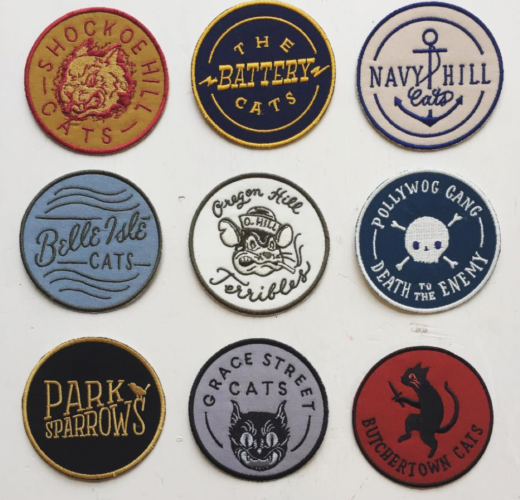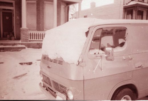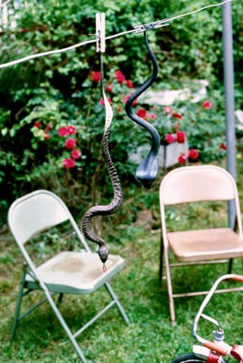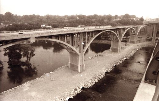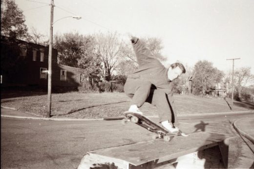
Courtesy of Billy Pickett. By the way, in appreciation of allowing his photos to be posted here, here is his business card-

Category Archives: history
New Interpretive Sign On North Bank Trail
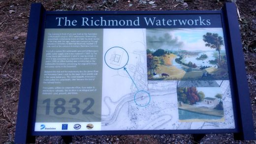
There is a new interpretive sign beside the canal on the North Bank Trail showing the location of the old water works below Hollywood Cemetery.
Laurel and Broad
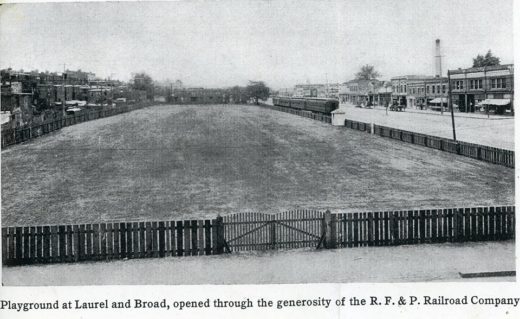
This photo shows the RF&P RR train tracks on Broad Street in the first quarter of the 20th century. This view (maybe 1915?) is westward, with the Elba train station at the rear of the view. This playground was arranged through the R.F. & P. RR by “Mrs. Bolling, of the Richmond Playgrounds Association”. It harkens to a time when Oregon Hill could sort of claim to extend to Broad Street.
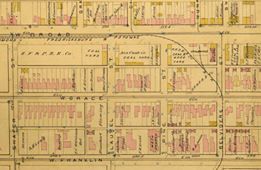
Here is part of the 1889 Baist map, which shows how the train turns from W. Broad to Belvidere then heads down past the penitentiary. The train tracks turned at Pine, thence south on Belvidere, and turned east along Byrd street, entered level, through a tunnel, to continue downtown to the old Byrd street depot.
(Special thanks to Richard Lee Bland and Fred Rodgers for the images and history notes, as seen on the Fans of Monroe Park FaceBook page.)
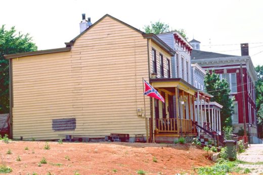
China Street circa 1990
Photo courtesy of Bill Altice.
Throwback Thursday: Hotel X
Bad photo of most of the cover of Hotel X’s Residential Suite album, recorded in 1993 and released in 1994 on SST Records
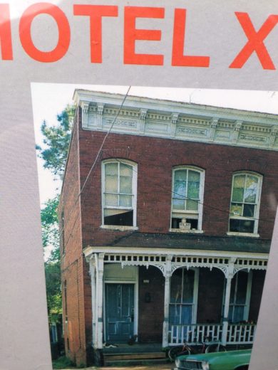
Before it was the name of the still-morphing local avant-garde jazz/rock band, it was the nickname of this Oregon Hill house on Idlewood that used to often offer lodging for touring musicians.
And tomorrow night:
Kokanko SATA + Assaba DRAMÉ + Lamine SOUMANO
Malian String Trio adds RVA to U.S. tour, reveals the Mande touch in Jazz and the Blues
HOTEL X
Richmond’s Afrodelic Funk experience.
8-piece band playing original African-inspired groove music
Friday, 23rd September 2016
At the Neighborhood Resource Center of Fulton Hill
1519 Williamsburg Road, Richmond, VA 23231
www.nrccafe.org
This concert in honor of Mali’s National Independence Day will benefit the Segou-Richmond House. Kokanko’s fantastic trio is lending their gifts to help VFOM raise funds for this joint project between our two sister cities: The Segou-Richmond House will be a community center to support removing barriers to girls education and social empowerment through sports, the arts and IT. On 6 acres of land near the Niger River, donated by local Cheick Mansour Haidara Foundation, the Virginia Friend of Mali and Segou’s Sister City Committee has begun construction of the site’s water source – a 10 meter deep well – that will facilitate the making of bricks, the playing fields and next phases of building.
Continue reading
Richmond In Civil War’s End Photos Tour On Saturday
From National Park Service press release:
RICHMOND, Va. – This fall, park rangers from Richmond National Battlefield Park invite the public to enjoy a heaping helping of history while being active outdoors. Through the park’s Half-Day Hikes series, visitors can explore a variety of historical topics at the dates and locations listed below – all while enjoying the great outdoors! All programs are free and do not require registration.
September 17 – Richmond in Photographs (3-4 hours). Over 300 photographs were taken in Richmond in the immediate aftermath of the Civil War. This walking tour will focus exclusively on these images of a vanished landscape, providing participants a unique “then and now” opportunity to view the city. Ranger Mike Gorman is an expert in Richmond’s Civil War photographs and will lead the tour. Expect extensive uphill and downhill walking; visitors are advised to wear comfortable footwear, wear sunscreen, and bring water. Tour begins at Tredegar Visitor Center (470 Tredegar Street, Richmond) at 12:30 p.m.
The Chuck Wagon
Throwback Thursday strikes again.
Another photo from Bill Altice: The Chuck Wagon, 1990
Throwback Thursday with ‘The Lady in the Lavender Hat’
It is Thursday, right? Holiday sometimes throws people off.
Anyway, Beth Stanford Tubb has graciously agreed to share stories of her grandmother and her early life on Oregon Hill (born and lived at 811 W. Cary Street). She has put many of these on her blog, Eliza Jane.
Here’s a sample:
The Lady in the Lavender Hat
Claryce, my “Granny”, was born at home and grew up in an old Richmond neighborhood called Oregon Hill. It was 1923. For a variety of reasons (each their own short story, to be posted later), she left St. Andrew’s School after the eighth grade in order to get a job and help her family financially.
Each day Claryce would ride to work on the trolley. She enjoyed the views, watching the city go by, usually with the same group of people. One morning, a woman got on the trolley who caught Granny’s attention: The woman had beautiful auburn hair, pulled back in a low bun, crowned by a lavender hat.
Each morning my grandmother, still a teenager, would secretly wait for the woman with the auburn hair and lavender hat to board the trolley. Granny marveled at her beautiful skin, her kind eyes, her auburn hair, and the way it looked so lovely against the lavender.
Once in a while Granny was free from helping around the house and caring for her three siblings, one of whom had Cerebral Palsy. She would meet her friends at the ice cream shop and hang out much the way we do in coffee shops today. At this point, she was around eighteen years old. There was a boy also hanging around the ice cream shop who was particularly handsome. He reminded Granny of Humphrey Bogart. She got up the nerve to talk to him and, having no money that day, asked if she could have a lick of his ice cream. His name was Herbert.
Herb and Claryce began dating and would ride around town on the trolleys for ten cents, holding hands. “Just people watchin’” she’d say. Eventually Herb (my grandfather) took Claryce home to meet his mother. As they opened the front door and entered the parlor, Granny could not believe her good fortune: There, smiling and holding out her hand, stood Lois Ann, the woman from the trolley, the lady with the auburn hair and lavender hat.
Carter’s Dry Goods/Notions (1990)
Photo courtesy of Bill Altice.
Dueling Maps of the Towpath, Again?
Nothing better than a good history rumble, and RVAHub.com may have started one with a post on the history of Harvie’s Pond that tries to reintroduce some troubling assertions about the history of the James River and Kanawha Canal.
What’s particularly worrisome is how RVAHub.com is glossing over the earlier debate itself.
From a 2013 post on this site, entitled “Dueling Maps of the Towpath”:
Venture Richmond Director Jack Berry gave a presentation on the proposed amphitheater at the July meeting of the Oregon Hill Neighborhood Association. One the main assertions Berry made was that the tow path on the south bank of the canal was only 12 feet wide until it was enlarged in the 1880s to make way for the railroad. He wants to remove over half of the tow path on the south bank of the canal, from 25 to 12 feet to improve the sight lines of the the proposed amphitheater.
Disproving Berry’s assertion is the 1848 plat of Lewis Harvie’s property on file at the Henrico Courthouse (Plat 3-417), which is far more detailed than the Morgan map cited by Berry. This plat is of such detail that it actually gives the dimension of the tow path as being 30 ft. wide at the location of what is now Venture Richmond’s proposed amphitheater. (See measurement on the attached Henrico Plat below the word “Path” to the left of the “House.”) The east-west street above the canal is the same width as the tow path and is also labeled “30 feet wide.”
This 1848 Henrico plat establishes that the towpath was at least as wide as it is today during the canal’s primary period of significance, and long before the railroad purchased the right-of-way on the canal bank. This canal was carefully engineered with an impermeable “puddled” clay layer that would be irreparably damaged if half of the south canal bank is removed.
Sadly, this has happened. In late June, early July of 2014, Venture Richmond ignored citizen concerns and compromised the integrity of the historic canal.
In doing so, Venture Richmond and City government ignored the findings of a large report on this historic area that was completed earlier that year. That report concluded with this paragraph:
In 1989 a joint Virginia House and Senate resolution honored the bicentennial anniversary of the opening of the James River Canal, recognizing that the “James River Canal, around the falls of the James River in Richmond, Virginia was the first operating canal system with locks in the United States,” and recognizing the canal, “… as a valuable, scenic, historic and economic resource to the Commonwealth and its capital city.” The James River and Kanawha Canal has survived and been treasured as a remarkable feature for a dozen generations. Will we be the generation that jeopardizes the canal, allowing the tow path embankment of this rare, historic structure to be cut because it blocks the view of a rock band?
It’s definitely worth noting that Jack Berry, as the Executive Director of Venture Richmond, dishonorably broke a repeated public promise to this community and government. From neighbor Todd Woodson:
“It is outrageous that Venture Richmond is breaking its repeated promises to submit the amphitheater plan to an impartial state and federal review through the Section 106 process. We have spent a year researching the canal, and we have documentation that the current tow path and and embankment are authentic and will be greatly damaged by the amphitheater plan.”
Flash forward to 2016 and the same Jack Berry is now running for Mayor, complete with a slick video and lots of support from the Ukrops and other members of the local corporate oligarchy. Does anyone doubt that Berry, if elected Mayor, will put his backers’ corporate interests over the concerns of citizens and neighbors? As the election draws nearer, there are other important points to consider and I will try to get to them, but this “history debate” says a lot about the character of Berry. Also, is Venture Richmond is disingenuously delaying its interactions as they wait to see if Berry is elected or not?
Sure, a lot of people may not care that much about a nerdy debate over old maps, water levels, and historic preservation (though it should be held in higher regard based on future planning, and more!), but the bigger picture is who owns the history as we get ready to elect our new leaders. Sadly, I cannot help but compare this RVAHub.com post, which puts forward Venture Richmond’s version, with previous attempts to push Venture Richmond’s propaganda (to the point of dishonestly suggesting that this neighborhood is against the Folk Festival). The stance of this community news site is that the history belongs to all of us, and while different interpretations are certainly welcome, they should not be used as tools of corporate hegemony to the detriment of the community and the truth.