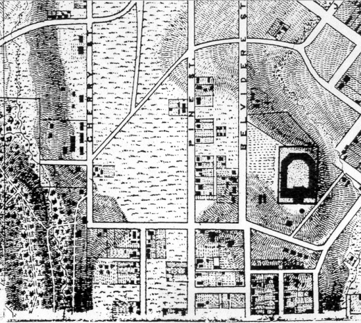
The 1867 Mitchie/Micheler Corps of Engineers map shows the buildings and topography of the entire Richmond area. The attached small detail from the huge map shows a portion of the Oregon Hill neighborhood between the horse-shoe shaped Penitentiary on Spring Street on the right and Hollywood Cemetery on the left. This map shows many homes that were built in Oregon Hill by the Civil War. These houses typically were small workers’ dwellings with gable roofs. Quite a bit of development is shown south of Spring Street, probably because much of this area of the neighborhood was included in the Belvidere estate, which was subdivided around 1817.
Much of the 1867 Mitchie/Micheler map has been placed on the Civil War Richmond website, available for free download:
http://www.mdgorman.com/Maps/1867_engineers_map_of_richmond.htm
Photo credit: Civil War Richmond website (from original map in the National Archives)

