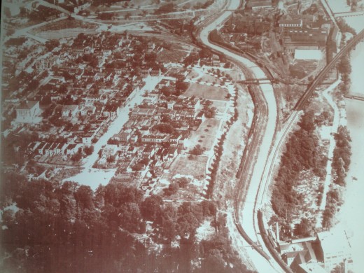
This is a photo that I ordered from the Library of Va. and had them crop the photo to show Oregon Hill. (I have the high-resolution print.)
The photo was taken in the 1930s when they were planning the Lee Bridge, which was built in 1934. (You will notice that Lee Bridge is not in the photo.) At this time Belvidere was no wider than the other north-south streets in O.H. Every building south of Holly has been demolished except for the gazebo and two surviving buildings on Riverside Park. Grace Arents School is visible on the left of the photo. The canal is shown with the walk-bridge that allowed many O.H. residents to walk to jobs at Tredegar.
Oregon Hill
News For Oregon Hill, in Richmond, VA

