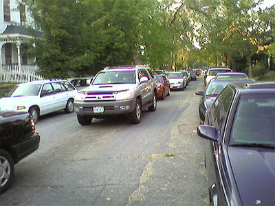
Just got back from walking the dogs- man, the VCU traffic congestion is out of control. Makes me so much eager to post some thoughts on the latest draft map of western downtown from the City’s Community Development downtown planning process…
Is this really a new map? What about the EXISTING pedestrian/bike ramps down to the canal area from Oregon Hill Riverside (RiverVIEW!) Park on the western side and the Belvidere greenway and recently repaired stone Overlook on the eastern side?
I strongly doubt the neighborhood will willingly give up Pleasants Park (corner of Albemarle and Laurel) over to development. I thought that was clear already.
Parsons Linear Park could use some better connections between blocks, but what about continuing the Belvidere greenway north to Broad? Why does that idea get no love from the City and VCU?
What about the Idlewood roundabout plan for the Belvidere exit off 195 (west of William Byrd, near Hollywood Cemetery)?
Are more parking garages going to solve the parking problems caused by VCU? I don’t think so.
How about metered parking along Cary and asking VCU to embrace the City’s mass transit as well as more creative solutions- Flex Car or banning first year students from bringing cars to campus?
Along those lines, where is the streetcar plan for Cary Street?
Now might be a good time to dust off those early 1970’s plans for a Virginia Transportation Museum just below 2ndStreet at the Virginia War Memorial. It could showcase the inter-modal travel of canal, car, bicycle, train, streetcar, pedestrian.
Those are just a few (hopefully provoking) thoughts, but please do share your responses here AND with the City’s Community Development Dept. Please attend the next Round on September 27th.


I think that Oregon Hill’s roads are more in need at this point. I have to get my wheels realigned all the time.